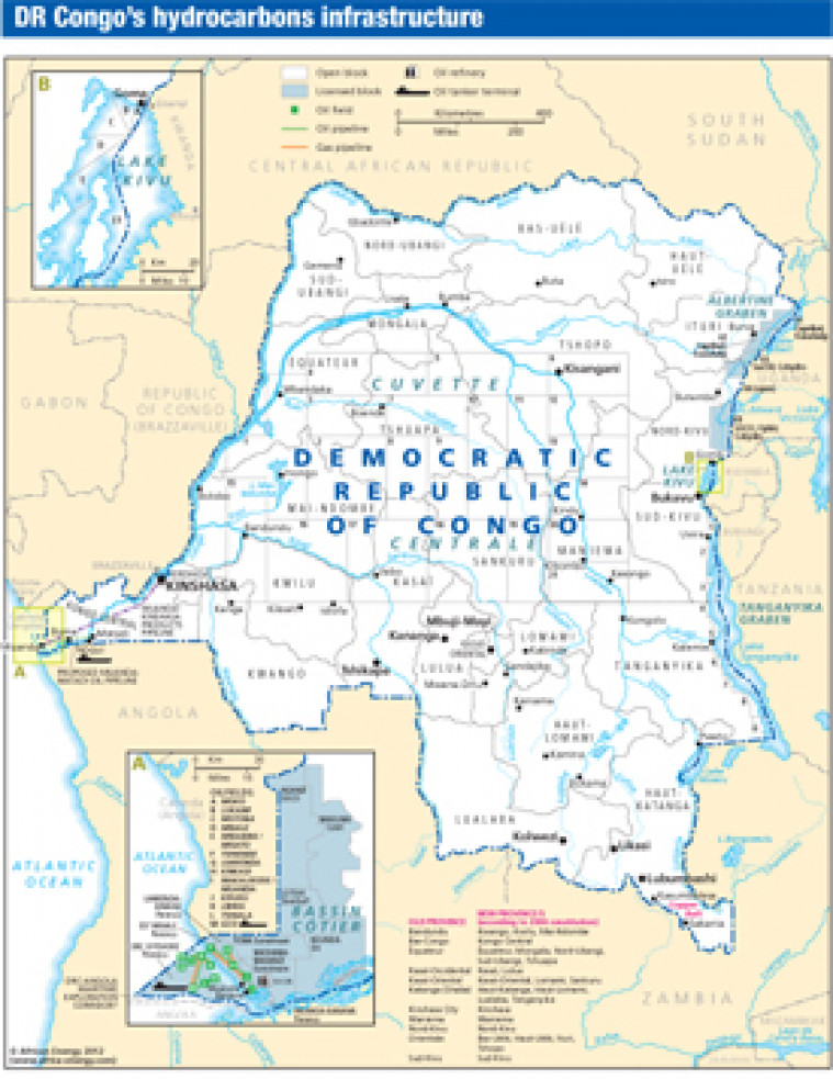
Published in April 2012 as part of the African Energy Atlas 2012, this map provides an overview of licensed and open acreage onshore and offshore Democratic Republic of Congo. Inset maps show Lake Kivu, and an enlargement of the offshore, including field names.
Single African Energy map
£895
(1 standard map)
Subscribe to African Energy
African Energy is a brand of


