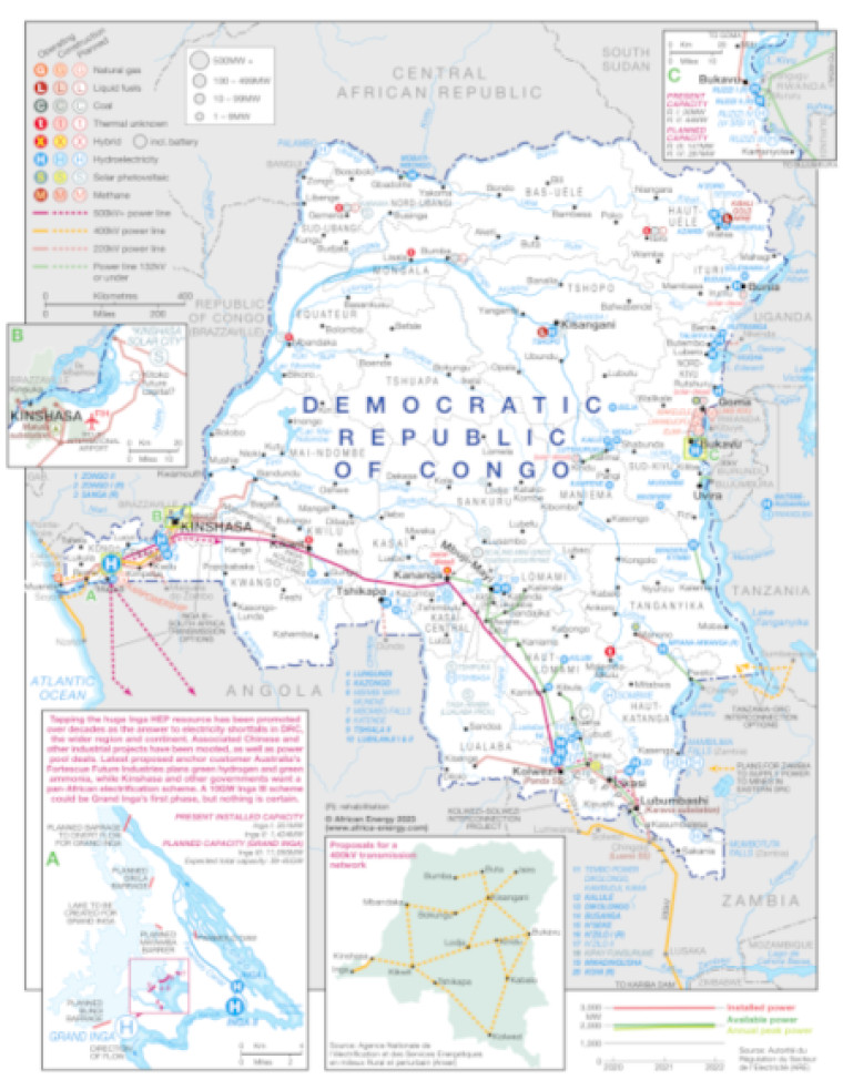
Revised in September 2023, this map provides a detailed view of the power sector in DR Congo. The locations of power generation facilities that are operating, under construction or planned are shown by type – including liquid fuels, natural gas, coal, hybrid, hydroelectricity, solar PV and methane.
Generation sites are marked with different sized circles to show sites of 1-9MW, 10-99MW, 100-499MW and 500MW and above.
An inset shows the Inga hydroelectric power (HEP) projects in detail, with notes. Two other small insets show in greater detail Kinshasa and the region to the north east and the area south of Lake Kivu.
A further inset illustrates proposals for a 400kV transmission network.
A small chart shows installed, available and annual peak power capacity over the period 2020-2022.
Existing and future transmission and distribution lines are shown ranging from 132kV and under to 500kV+. Actual and planned cross-border interconnectors are also shown including lines to Angola, Congo B, Tanzania and Zambia.
Power generation data was drawn from our African Energy Live Data platform, which contains project level detail on power plants and projects across Africa.
The map is presented as a PDF file using eps graphics, meaning that there is no loss of resolution as the file is enlarged.
Single African Energy map
£895
(1 standard map)
Subscribe to African Energy
African Energy is a brand of


