Cameroon's hydrocarbons infrastructure


Map

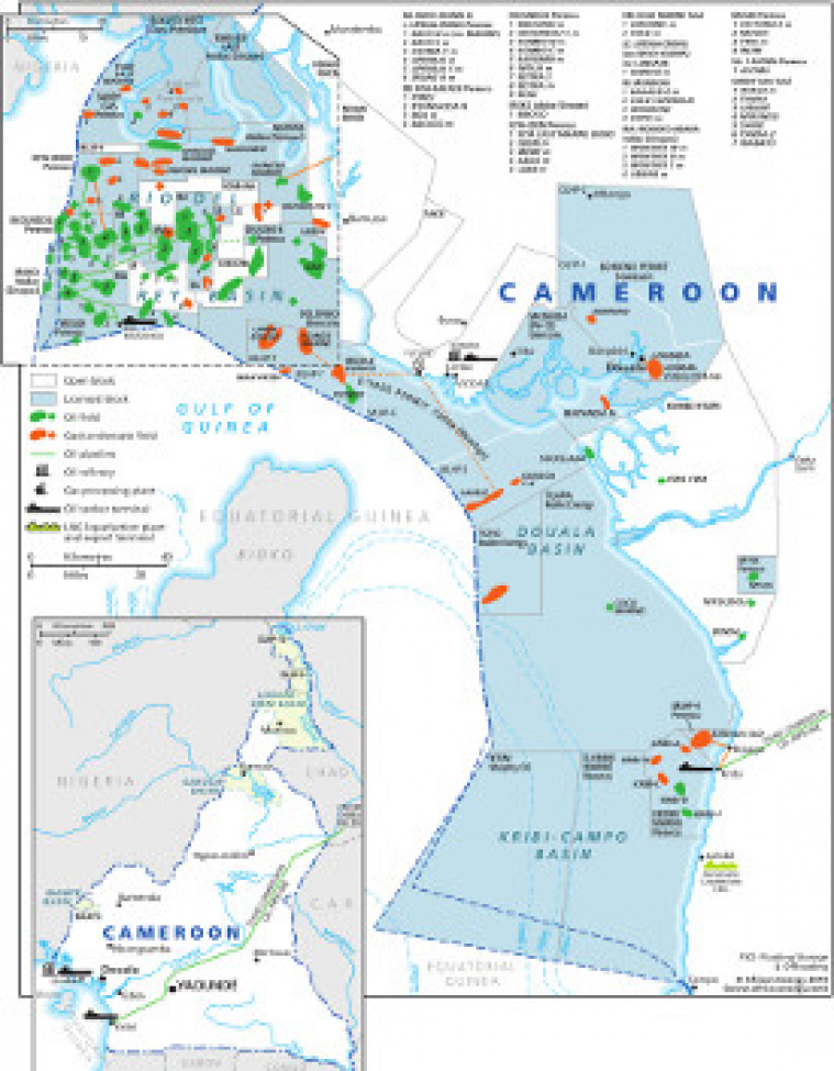
Revised in November 2014. This map provides an overview of oil and gas exploration and production in Cameroon. Open and licensed blocks are marked with the locations of oil and gas fields shown. Oil refineries as well as oil terminals are shown. The map is made using eps graphics, which do not lose resolution as they are enlarged.

Subscribe to African Energy

View subscription options

This map is available to registered users

Login

Don't have an account?

Register for access to our free content

An account also allows you to view selected free articles, set up news alerts, search our African Energy Live Data power projects database and view project locations on our interactive map

Register

Interested in more than one map?

The African Energy Atlas is the essential reference book for all energy professionals working in Africa, with maps, graphics and articles covering all aspects of the energy sector.

Take a closer look