Botswana country map


Map

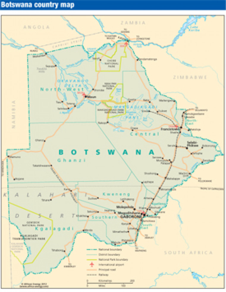
Published in March 2012, this map of Botswana shows the location of principal roads, railways, airports and settlements. The boundaries of the Chobe, Makgadikgadi Pans, and Kgalagadi national parks are also shown.

Subscribe to African Energy

View subscription options

This map is available to registered users

Login

Don't have an account?

Register for access to our free content

An account also allows you to view selected free articles, set up news alerts, search our African Energy Live Data power projects database and view project locations on our interactive map

Register

Interested in more than one map?

The African Energy Atlas is the essential reference book for all energy professionals working in Africa, with maps, graphics and articles covering all aspects of the energy sector.

Take a closer look