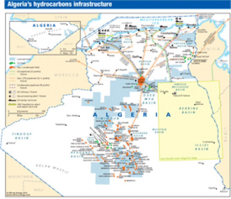
Published in April 2012 as part of the African Energy Atlas 2012, this map provides an overview of Algeria's hydrocarbons industry. The location of major oil and gas fields is shown, alongside associated downstream infrastructure including pipelines, refineries, tanker terminals, gas processing plants and LNG liquefaction facilities. The south-east of the country – including the Amguid Messaoud, Berkine and Illizzi basins – is shown on a separate map.
Single African Energy map
£895
(1 standard map)
Subscribe to African Energy
African Energy is a brand of


