Algeria’s 2014 licensing round map


Map
Issue 270
30 January 2014

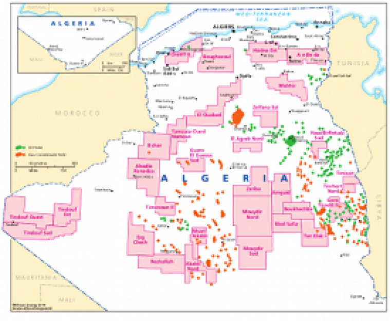
Published, January 2014, this map shows the name and location of acreage included in Algeria's 2014 bid round. The available acreage is shown alongside an overview of the location of existing oil and gas fields.

The map is a PDF file, made using eps graphics, which do not lose resolution as they are enlarged.

Single African Energy map

£895

(1 standard map)

Subscribe to African Energy

View subscription options

Don't have an account?

Register for access to our free content

An account also allows you to view selected free articles, set up news alerts, search our African Energy Live Data power projects database and view project locations on our interactive map

Register

Interested in more than one map?

The African Energy Atlas is the essential reference book for all energy professionals working in Africa, with maps, graphics and articles covering all aspects of the energy sector.

Take a closer look