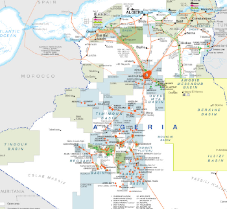
The main map provides a view of the whole country, while a second map provides a more detailed look at a region covering the Amguid Messaoud Basin, Berkine Basin and Illizi Basin.
Open blocks are shown alongside Sonatrach prospection areas, Sonatrach exploration/operating areas and IOC/JV exploration/operating areas.
Oil and gas fields are marked, alongside associated downstream infrastructure such as pipelines, tanker terminals, refineries, gas processing plants and LNG facilities.
The map is available as a PDF file using eps graphics, meaning that there is no loss of resolution as the file is enlarged.
Double African Energy map
£950
(1 two-page map)
Subscribe to African Energy
African Energy is a brand of


